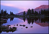
The Uintas just don't get any more scenic than this loop hike. Both the Red Castle area and Henry's Fork Basin are surrounded by magnificent mountains and huge lakes, and are filled with moose. As you might expect, this area is also very popular so you'll probably see plenty of people as well. Huge numbers of people climb Kings Peak each year and most do it via Henry's Fork Basin.
For the most part, the trails in both basins are broad, easy to follow, and well-marked. The loop hike begins at the China Meadows Campground/Trailhead, follows the East Fork Smiths Fork River, continues over three passes (Smiths Fork, Anderson, and Gunsight Passes), and connects back to the beginning trail via Lake Hessie.
Four miles from China Meadows, be sure to take note of the Lake Hessie trail which joins on your left. The Lake Hessie trail is also part of the lower Highline Trail (#105).
At the northern end of Broadbent Meadow you'll cross a bridge which offers your first breathtaking view of Red Castle Peak. A mile and a half later a trail junction offers the choice of either exploring the Upper Red Castle Lakes, or turning left, continuing the loop hike to Smiths Fork Pass. The upper lakes have spectacular scenery with the imposing spires of Red Castle Peak and rugged north face of Wilson Peak as a backdrop.
After the moderate climb and descent of Smiths Fork Pass, turn left on the Highline Trail and get ready for a 1400 foot climb to the highest point of any trail in the Uintas -- Anderson Pass. Kings Peak, the highest point in Utah, is just a mile south from the top of the pass.
The descent from Anderson Pass is much less steep. Hint: a relatively recent trail shortcuts to Gunsight Pass, following the base of the cliffs at the bottom of Anderson Pass.
Once in Henry's Fork Basin, you can take a couple of different trails, both of which easily connect to the lower Highline Trail and Lake Hessie. Just consult your map so you don't miss important trail junctions, which may or may not be marked. Incidentally, Dollar Lake is a great place to start a climb of Gilbert Peak, Utah's 3rd highest point.
Watch for cairns when hiking the trail over Flat Top Mountain to Lake Hessie. Two miles along the trail from Lake Hessie brings you back to the East Fork Smiths Fork trail again. Turn right to reach China Meadows.